The
Ouse Washes Website
- Contents of this page
- related pages on this site
- related pages on other sites
- Home page and full site index
- Recommended OS Maps
- page last updated: 05 Jan 2017
- Please "refresh"/"reload" page
Your computer stores images of webpages you visit in a "cache". When you re-visit, the stored page may be displayed. To see if it has changed, click the "refresh" or "reload" icon at top of screen. Designs/colours vary, examples:


- Copywright, acknowledgements
- Can you correct/add anything?
| The Ouse Washes Website Counterdrain/Old Bedford |
Cranbrook Drain/Counterdrain/Old Bedford River system
THIS IS AN EARLY AND VERY INCOMPLETE DRAFTIntroduction
Like most watercourses in the Fens, this has more than one name, but with added complications. It comprises three drainage channels, or rather two channels plus the northern two-thirds of another. The other third of the latter was cut off and joined to yet another channel forming a completely different system. The two systems run alongside each other for many miles seperated by the Middle Level barrier bank which is the western rim of the Ouse washes and both include the name Old Bedford River in their titles - which causes much confusion.
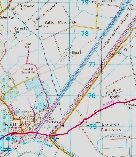
The common abbreviation for this system is CD/OBR, and it runs from Somersham to Salters Lode. (The other system is the Old Bedford/Delph River, OB/DR or OBR/DR for short, which runs from Earith Sluice to the John Martin Sluice at Welmore Lake.) Locally of course, sections are known by their individual names and for clarity I, like many others, do the same. Difficulty arises though when writers of official documents use the local name of one section when referring to another.
The first part of this system since c1970 is the Cranbrook Drain which starts near Somersham and drains 6,400 acres (1948 figure2) of groundwater and treated effluent discharge from the so-called "highland" areas around there and Colne before flowing south-east to Black Sluice just north of Earith.
There it joins what is now the start of the second part of the system, the Counterdrain (also known as the Counterwash Drain, yet another complication). The Counterdrain is shown on the 1950 OS map starting much further south in what is now a housing estate in Earith (and at a mill or pump on the 1901 OS map). (Yet another confusion is that Samuel Wells' map of 1829 doesn't show the sothern part, but he wasn't always accurate). I believe the section south of Black Sluice may have been filled in during construction of the Hovertrack in the early 1970s. .
Nearly all the water in this section is drained from districts within the Middle Level of the fens, but outside the jurisdiction of the Middle Level Commissioners, being managed by local IDBs, Sutton & Mepal (11,630 acres in 19482) and Manea & Welney (7,680 acres in 19482 ). It is also outside the floodplain of the Ouse Washes but can have a large effect on flooding within the washes.
The river then flows to Welches Dam where at a bend it joins the third section, the northern part of the Old Bedford River, which receives water from the Upwell IDB, and a small amount from private land at Lake Farm. Until 1948, the system could only be discharged (emptied) by gravity at Salters Lode, either though the old Bedford Sluice into the tidal River Great Ouse when tide levels allowed, or over a weir or spill-way just upstream of the sluice into Well Creek. Both methods are still used, but generally, if the sluice cannot be opened (due to tides or siltation) it is pumped through the Barrier Bank at Welches Dam into the OB/DR and subsequently discharged into the tidal New Bedford River or Hundred Foot Drain at Welmore Lake.
The CD/OBR system has been classified as a "main river" since late 1943/early 1944 after the Grt Ouse Catchment Board asked for and was given complete instead of partial control of the west (low) bank. They were already responsible for the Barrier Bank between it and the OBR/DR. Management has passed through various successor organisations and now is in the hands of the Environment Agency (EA).
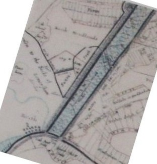
The Counterdrain and Old Bedford Rivers are both man-made but Cranrook Drain appears to be, or follows the course of, a natural watercourse, severed when the original Bedford River (later renamed Old Bedford River) was cut in 1632-1637. Nevertheless, a 2008 EA publication decribes it as an 'artificial waterbody'. All are shown on the Jonas Moore map dated 1684 below left, which I've turned clockwise 17˚ to align with the 1977 OS map on the right.
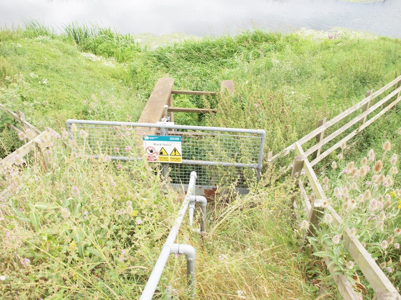
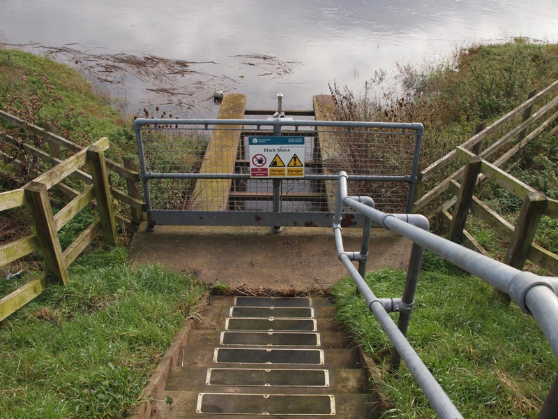
Black Sluice
This is, or was, a small brick tunnel through the Middle Level barrier bank (MLBB) at OS grid ref TL 3971 7595, 0.8m/1.35km north-east of Earith Sluice. It was due to be "filled in" in 2017 as part of the Middle Level Barrier Bank works but I haven't visited to verify that.It isn't mentioned in the Middle Level Acts 1 published in 1875, but it is named on the 1824-36 OS map and on Samuel Wells' map of 1829. I can't help thinking that it must have been a lot earlier than that.
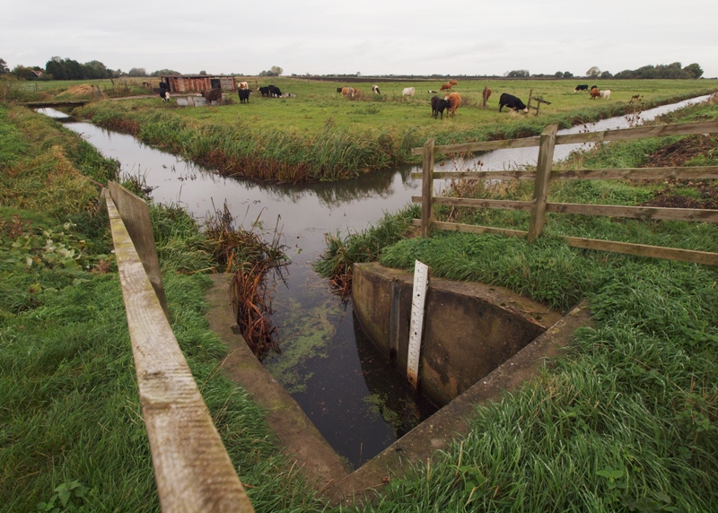
This photo aligns with the maps above.
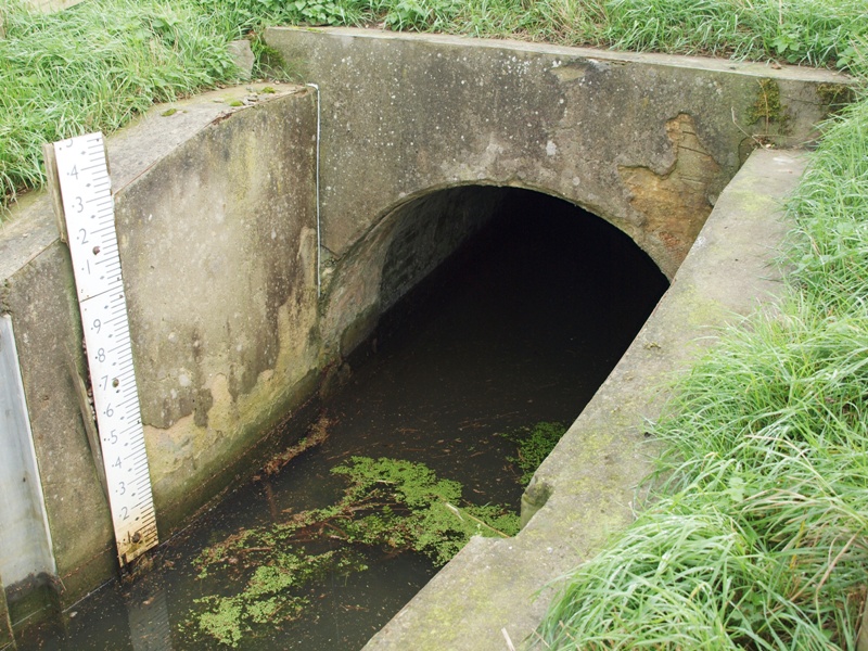 In the photo
above, the inlet into Black Sluice is at the bottom. The junction in the centre
of the photo marks the end of Cranbrook Drain flowing down from the left and into what
has been since c1970 the the start of the Counterdrain, flowing off to the right.
In the photo
above, the inlet into Black Sluice is at the bottom. The junction in the centre
of the photo marks the end of Cranbrook Drain flowing down from the left and into what
has been since c1970 the the start of the Counterdrain, flowing off to the right.The right photo shows the start of the tunnel and its brickwork.
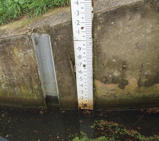
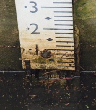
Note in both photos the water-level gauge, and slots in side walls for 'dam-boards' (timber or wooden planks placed across a sluice to seal it off for maintenance).
Photos: Eddy Edwards, Nov 2013
Prior to 2000, the only control was a flap gate at the outfall end, allowing floodwater from Cranbrook Drain to flow into the OBR/DR instead of into the Counterdrain. The sluice was described in a 1996 National Rivers Association (NRA) document as "moribund" (?) and hadn't been used for years and they were considering closure.
In a 1998 document, The Middle Level Commissioners (MLC) strongly opposed closure, indeed suggested that a "new pumping station at Black Sluice would be beneficial".
 In 2000, the
one-way flap gate was replaced with a penstock which enables water
to pass in both directions allowing, in theory, water transfer into
the Counterdrain from the OB/DR during summer for irrigation. However, a 2002 document said that was not
generally possible as levels in the OB/DR are lower than in the CD/OBR (quoted as approx 0.5m OD against 0.91m OD).
In 2000, the
one-way flap gate was replaced with a penstock which enables water
to pass in both directions allowing, in theory, water transfer into
the Counterdrain from the OB/DR during summer for irrigation. However, a 2002 document said that was not
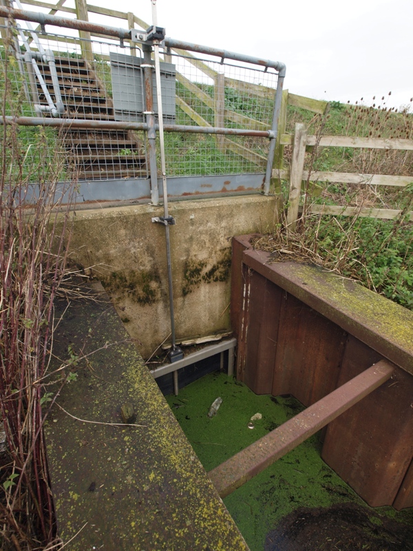
generally possible as levels in the OB/DR are lower than in the CD/OBR (quoted as approx 0.5m OD against 0.91m OD).Here you can see the top of the penstock frame just above the green cott in the OB/DR, and the long screwed rod which is turned to raise or lower the gate. Normally the rods are locked to prevent unauthorised use but I don't recall seeing any security device. But I guess few passers by would be carrying a large spanner to turn it.
This was the CD/OBR level on 1st November 2013
When I visited in July 2013 the way down to the penstock was heavily overgrown, but by my next visit in Nov 2013, the path was clear, with some human intervention I think rather than just die-back. Perhaps in readiness for opening the sluice for winter flood relief?
Feary's or Craneford (Farm?)
Named on 1824-1836 OS map.The start of the 1 mile Hovertrain test runs started just north of here.
The Jolly Bankers
Once there was a pub here (guess its name), a farmhouse or cottage, and and a (chain?) ferry across the washes to Sutton Chain.Now, there are two bridges. One, a Bailey Bridge (an ex-army temporary bridge) accessed via a flood-gate across a gap in the Barrier Bank, goes over the Old Bedford into the Washes.
Oh, and also a rather silly and superfluous sign erected, probably at great expense, by the EA.
Argents Farm
Named on the 1824-36 OS map as Meadlands Farm. Here there is an irrigation inlet from the Counterdrain into a field drain. In 1969-70 is was the site of the concreting plant built to supply material to the Hovertrack builders.The Gullet
Sutton Gault Culvert
Fortreys Hall Pumping Station
A little north of the A142 an Inland Drainage Board (IDB) pumping station known as Fortreys Hall discharges floodwaters, when necessary, from the IDB's area into the Counterdrain adding considerably to the flow.Welches Dam
Welches Dam
At Welches Dam the Counterdrain is joined to the northern section of the Old Bedford River, and is known as Counterdrain/Old Bedford. Here it used to be joined to the Forty Foot River by a lock, but that has been sealed off since c2005. (For more about this and other river systems, alternative names, and changed functions and courses, see "related pages" on left and use the "other rivers" link)
A little northeast of the lock is Welches Dam Pumping Station which pumps excess water out of the CD/OBR into the River Delph.
The river continues northeast, under a sluice at Welney, then takes in more drained water from two more IDBs Upwell IDB and a small amount at the north-east end from private farmland. The Welney sluice gate is shut when Welches Dam PS is operating to prevent these intakes from flowing upstream and overloading it.
At Salters Lode the river can be discharged by gravity into the Tidal River (Great Ouse) via the Old Bedford Sluice, or if that is unable to be opened due to the tide or siltation, into the Well Creek over a weir or spillway.
Sluices, weirs and locks
| From south to north | from | to | OS grid ref | built, power | owner (IDB) |
| Black Sluice | Cranbrook Drain | Old Bedford River (south) | TL 3971 7595 | EA. Two-way flow since 2000. Removed 2017 (?) | |
| Welches Dam Lock | Old Bedford River (north) | River Delph | EA | ||
| Welney Gate | 1973 by GORA | EA. a single vertical gate should only be lowred when Welches Dam PS pumping | |||
| Old Bedford Sluice/lock | Old Bedford River (north) | Tidal River (River Great Ouse) | EA |
Pumping Stations
| From south to north | from | to | OS grid ref | built, power | owner (IDB) |
| Fortrey's Hall | Counterdrain | TL | 1840 | Sutton & Mepal IDB | |
| Welches Dam | Old Bedford River | River Delph | 1948 | Environment Agency | |
| Purls Bridge | Manea & Welney IDB | ||||
| Glen House | Manea & Welney IDB | ||||
| Cock Fen | 19751 | Upwell IDB | |||
| Upwell Fen | Upwell IDB | ||||
| Lake Farm | private |
Irrigation inlet slackers
| From south to north | inlet from | OS grid ref | built, power | owner (IDB) | |
| Fortrey's Hall | TL | 1840 | Sutton & Mepal IDB | ||
| Purls Bridge | Manea & Welney IDB | ||||
| Glen House | Manea & Welney IDB | ||||
| Cock Fen | 1975* | Upwell IDB | |||
| Upwell Fen | Upwell IDB | ||||
| Lake Farm | private |
Bridges
| Name or location | OS map ref | type | construction | built rebuilt |
access |
| Jolly Bankers | |||||
| Sutton Gault | |||||
| Mepal by-pass | |||||
| Fortreys Hall | |||||
| Welches Dam | road | reinforced concrete 34 feet single span |
c1946 | ||
| Railway | |||||
| Welney | |||||
| Saters Lode | |||||
| Old Bedford Sl |
Pubs & Inns
Data Sources
| note | date | publication |
| 1 | 1875 | The Middle Level Acts. (1810,1844,1848,1862, 1867, 1874.) (Kindly donated by Carole Eaton, Fen Ditton) |
| 2 | 1948 | Welches Dam, Souvenir of official opening. Published by River Great Ouse Catchment Board (Copy courtesy Patrick Cox, Prickwillow Drainage Engine Museum) |
| 3 | 1949 | Welches Dam Food Prevention Scheme. The Allen Engineering Review. (Copy courtesy John Baker, EA Ely) (This is almost entirely a copy of the Souvenir publication above.) |
| 4 | 1996 | Counter Drain Flood Defences Executive Summary May 1996 |
| 5 | 2004 | Cranbrook Drain/ Counter Drain (Welches Dam) Strategy Study. Atkins for EA |
| 6 | 2006 | The Old Bedford including Middle Level Catchment Abstraction Management Strategy |
| 7 | 2008 | Cranbrook/Counterdrain Flood Risk Management Strategy |
| 8 | ||
| 9 | ||
| 10 | ||
| 11 | ||
| 12 | ||
| 13 |
Most of the rivers and drains of East Anglia are listed and their courses described on the "Wisbech and the Fenlands" website, which also has a wealth of historical information about the area.