Page good for smart-phones. On PCs/Laptops it may look too large. To reduce press "Ctrl" & "minus" or click "View" then "Zoom out"
Created May 2011, last edited:
31/03/26, 16:03
Introduction
I'm Peter Cox (although some will know me by my original website alias of Eddy Edwards) and I came to live and work not far
from "The Washes" in the 1970s. To me they seemed rather mysterious, where cattle and
sheep grazed in summer, and in winter they were flooded and invaded by swans.
Ordinary
folk didn't venture into them, and few roads crossed them. In winter the rivers
inevitably drowned all but one road at some stage causing frustration, long diversions
and delays. Information from the river managers
was sparse so most people didn't know in advance and those who could read the signs
didn't tell. The only road that
didn't flood wound slowly through a small village where normal traffic volumes were bad enough, but when swollen by
diverted vehicles, it was awful, for both residents and motorists.
For many years I just accepted the situation, and was grateful when one road was
raised a little (the A1123 at Earith by 10 inches in 1978) which made winter travel a bit
easier, and a by-pass built at another (A142 at Mepal, 1984) to the relief of all. There was
some hope in the early 1990s that a third crossing (A1100 at Welney) where the road was, and
still is, regularly inundated for weeks, sometime months, would be raised, but according to
the local website in 2010 no solution or even improvement is likely. There was much
talk about this again in 2015/16 and predictions that something would, at last, be done. I'm
one of many not convinced.
2025 page revision: my scepticsm was well founded. There have been yet more talks, but apart from some new electronic flood-depth signs for the A1101 at Welney, and resurfacing the Wash Road, there are no plans to raise the road.
In the 1990s I began to make occasional forays along some of the river banks, and in the late 2000s I visited more often, this time
with a camera, but I had no plan at that time to properly record what I found, or connect the operation of one place with any other.
Scroll on down to read the rest of the story of choose a subject from the menu. To open: press firmly and hold, then tap a subject; or hover mouse. You can return to the index anytime via button on left.
Later, in the very early 2010s, I tried to find out why the seemingly simple process of moving the river from one end of the
Washes to the other without disrupting peoples lives every winter seemed beyond the abilities of those in charge. I discovered
that in fact it was by no means straightforward, and there was a complicated "system" to try to balance various, and
sometimes conflicting, interests.
Management of "the system" has passed from one body to another (four in my short
time here) although many personnel were retained by the successor organisations. Each new body was either bigger or more "focussed",
or both, than its predecessor yet still seemingly unable to do any better, and still no-one able to explain "the system",
or "the problems", in a way I could fully understand. No-one agreed anyway, the same question to a dozen people
would get as many different answers. And I got the feeling that some officials did not always tell the full story; the truth perhaps, but not
the whole truth. (I must add that the EA staff I've met since 2013 contradicted
that view, seeming very frank about their roles and providing a good deal of current
and historic information about the management and operation of the Washes
water-control structures for which I am most grateful) .
My Project
So began my project in January 2011, to learn what "the system" involves, and to attempt to make it understandable to others.
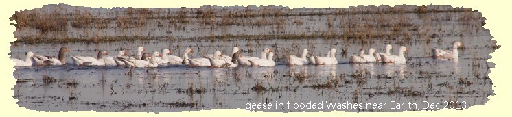
In the process I've become fascinated by the various engineering structures in, around or effecting the Washes and their links to bygone ages and I've discovered that while there's lots of stuff on the web about the flora and fauna and recreation (boating, fishing and shooting), and many photos of floods, sunsets, swans and ducks, there's not very much about the engineering aspect, and what there is is limited to specific areas.
I therefore set myself the following aims:
To learn how the Washes are managed in the face of diverse interests of flood defence, drainage, irrigation, grazing, conservation & recreation.
To monitor current flood control actions, compare them with agreed plans and establish reasons for any differences.
To walk both banks of the Old and New Bedford Rivers recording every structure affecting or controlling the Washes.
To research the history of the people and organisations responsible for the Washes and the structures they built.
To put my findings on-line in a simple easy to navigate format
To encourage others to assist informally by commenting on and adding to the data posted
Please note that this project and website are personally funded and not affiliated to the Ouse Washes Landscape Partnership [Scheme] which launched fully 12 months after mine, or its lottery-funded website with a similar domain name to mine. My project is limited to the Ouse Washes as defined below ; theirs includes communities around the Washes and places some distance from the Washes, and also promotes fen-land tourism, arts and crafts, and some expensive long-term dreams.
Occasionally I too have veered off-course, away from the Washes and their immediate surrounds, to Ely, Littleport and Upwell, but in all cases there is still an important link with the Washes.
In autumn 2015 I also made another departure from the aims above - I began giving slide-show talks on some subjects, with much more coverage than shown
on-line. I also planned to publish some booklets and guide books. Sadly other commitments have not allowed me to do so nor to update the site much, and I'm no longer able to give talks. But my passion to learn and inform is as alive as ever and in Nov 2025 I began updating the HTML code and restyling pages to be easier for viewing on smart phones and other touch-screen devices.
My Website
I launched this website in May 2011 with just a single page. By September 2012 there
were 40 pages, and by Feb 2016 a further 20. A variety of face-lifts have been tried
on selected pages. A site logo is being rolled out together with new headers, the
latest with a titled slide show within a container with rounded corners and a bottom
shadow. Menu and comment boxes are receiving similar treatment. However, it is still
very much work in progress, in both content and display. There are no distracting
adverts or sponsor logos, but lots of navigation links and tables for easy access to
basic facts with further links to detailed pages and photos. Pop-out navigation
menus on the main pages enable viewers to get to virtually every page or
page-section with just one or two clicks and quickly zip around the site. I tried a
menu that floated down and was always visible as you scrolled - it enabled instant
access to contents (page and site) without losing where you were - but that does not
work well on tablets and smart-phones which were little used when the site was first
designed. Starting in March 2016 I'm replacing that with a floating "back to top of
page" link in the left column which should provide easy and rapid access to page
contents and site index.
I've added some slideshows, some with and some without changing captions, some
within existing pages running automatically as here, others as stand-alone shows
which can run automatically or be manually controlled. My "guided tour" slideshows
will become an increasingly important part of this project.
Page width is 960px to fit older conventional (non wide-screen) monitors and tablets, etc.
Pages will be amended, expanded or occasionally replaced by others, and new ones
added, as my project progresses. Some pages lack content or have images missing, and
inevitably there'll be broken
links.
I had planned to deal with those shortcomings and add more pages but domestic life has made updating the site increasingly difficult.
My Data Sources
If this remains displayed, your computer's settings need attention or you may need to "allow blocked content".
I've learned to question some of the things I read during my researches, and wherever possible I've consulted the earliest available sources and compared one with another. It's suprising how many relatively recent writers have simply repeated earlier mistakes.
Initially, I made great use of Cambridgeshire's public libraries. Later, I built up my own extensive collection of books, maps and documents going back to the 1740s, many of which are shown on the right. Linger here for a moment, and see the scrolling book covers and titles.
I have made use of those throughout the site and I've also obtained very many others during the project.
I am greatly indebted to all those who have provided other documents, photos and information, and they are acknowledged where the material has been used.
Peter's Blog
Created May 2011, last edited: 31/03/26, 16:03
Introduction
I'm Peter Cox (although some will know me by my original website alias of Eddy Edwards) and I came to live and work not far from "The Washes" in the 1970s. To me they seemed rather mysterious, where cattle and sheep grazed in summer, and in winter they were flooded and invaded by swans.Ordinary folk didn't venture into them, and few roads crossed them. In winter the rivers inevitably drowned all but one road at some stage causing frustration, long diversions and delays. Information from the river managers was sparse so most people didn't know in advance and those who could read the signs didn't tell. The only road that didn't flood wound slowly through a small village where normal traffic volumes were bad enough, but when swollen by diverted vehicles, it was awful, for both residents and motorists.
For many years I just accepted the situation, and was grateful when one road was raised a little (the A1123 at Earith by 10 inches in 1978) which made winter travel a bit easier, and a by-pass built at another (A142 at Mepal, 1984) to the relief of all. There was some hope in the early 1990s that a third crossing (A1100 at Welney) where the road was, and still is, regularly inundated for weeks, sometime months, would be raised, but according to the local website in 2010 no solution or even improvement is likely. There was much talk about this again in 2015/16 and predictions that something would, at last, be done. I'm one of many not convinced.
In the 1990s I began to make occasional forays along some of the river banks, and in the late 2000s I visited more often, this time with a camera, but I had no plan at that time to properly record what I found, or connect the operation of one place with any other.
Scroll on down to read the rest of the story of choose a subject from the menu. To open: press firmly and hold, then tap a subject; or hover mouse. You can return to the index anytime via button on left.
The System
Later, in the very early 2010s, I tried to find out why the seemingly simple process of moving the river from one end of the Washes to the other without disrupting peoples lives every winter seemed beyond the abilities of those in charge. I discovered that in fact it was by no means straightforward, and there was a complicated "system" to try to balance various, and sometimes conflicting, interests.Management of "the system" has passed from one body to another (four in my short time here) although many personnel were retained by the successor organisations. Each new body was either bigger or more "focussed", or both, than its predecessor yet still seemingly unable to do any better, and still no-one able to explain "the system", or "the problems", in a way I could fully understand. No-one agreed anyway, the same question to a dozen people would get as many different answers. And I got the feeling that some officials did not always tell the full story; the truth perhaps, but not the whole truth. (I must add that the EA staff I've met since 2013 contradicted that view, seeming very frank about their roles and providing a good deal of current and historic information about the management and operation of the Washes water-control structures for which I am most grateful) .
My Project
So began my project in January 2011, to learn what "the system" involves, and to attempt to make it understandable to others.In the process I've become fascinated by the various engineering structures in, around or effecting the Washes and their links to bygone ages and I've discovered that while there's lots of stuff on the web about the flora and fauna and recreation (boating, fishing and shooting), and many photos of floods, sunsets, swans and ducks, there's not very much about the engineering aspect, and what there is is limited to specific areas.
I therefore set myself the following aims:
- To learn how the Washes are managed in the face of diverse interests of flood defence, drainage, irrigation, grazing, conservation & recreation.
- To monitor current flood control actions, compare them with agreed plans and establish reasons for any differences.
- To walk both banks of the Old and New Bedford Rivers recording every structure affecting or controlling the Washes.
- To research the history of the people and organisations responsible for the Washes and the structures they built.
- To put my findings on-line in a simple easy to navigate format
- To encourage others to assist informally by commenting on and adding to the data posted
Occasionally I too have veered off-course, away from the Washes and their immediate surrounds, to Ely, Littleport and Upwell, but in all cases there is still an important link with the Washes.In autumn 2015 I also made another departure from the aims above - I began giving slide-show talks on some subjects, with much more coverage than shown on-line. I also planned to publish some booklets and guide books. Sadly other commitments have not allowed me to do so nor to update the site much, and I'm no longer able to give talks. But my passion to learn and inform is as alive as ever and in Nov 2025 I began updating the HTML code and restyling pages to be easier for viewing on smart phones and other touch-screen devices.
My Website
I launched this website in May 2011 with just a single page. By September 2012 there were 40 pages, and by Feb 2016 a further 20. A variety of face-lifts have been tried on selected pages. A site logo is being rolled out together with new headers, the latest with a titled slide show within a container with rounded corners and a bottom shadow. Menu and comment boxes are receiving similar treatment. However, it is still very much work in progress, in both content and display. There are no distracting adverts or sponsor logos, but lots of navigation links and tables for easy access to basic facts with further links to detailed pages and photos. Pop-out navigation menus on the main pages enable viewers to get to virtually every page or page-section with just one or two clicks and quickly zip around the site. I tried a menu that floated down and was always visible as you scrolled - it enabled instant access to contents (page and site) without losing where you were - but that does not work well on tablets and smart-phones which were little used when the site was first designed. Starting in March 2016 I'm replacing that with a floating "back to top of page" link in the left column which should provide easy and rapid access to page contents and site index.I've added some slideshows, some with and some without changing captions, some within existing pages running automatically as here, others as stand-alone shows which can run automatically or be manually controlled. My "guided tour" slideshows will become an increasingly important part of this project.
Page width is 960px to fit older conventional (non wide-screen) monitors and tablets, etc. Pages will be amended, expanded or occasionally replaced by others, and new ones added, as my project progresses. Some pages lack content or have images missing, and inevitably there'll be broken links.
I had planned to deal with those shortcomings and add more pages but domestic life has made updating the site increasingly difficult.
My Data Sources
If this remains displayed, your computer's settings need attention or you may need to "allow blocked content".
Initially, I made great use of Cambridgeshire's public libraries. Later, I built up my own extensive collection of books, maps and documents going back to the 1740s, many of which are shown on the right. Linger here for a moment, and see the scrolling book covers and titles.
I have made use of those throughout the site and I've also obtained very many others during the project.
I am greatly indebted to all those who have provided other documents, photos and information, and they are acknowledged where the material has been used.
Website, page, personal & local info
to followIf you think there are any errors or ommissions on this page or would like to comment, please e-mail me and your response will be added.