Page good for smart-phones. On PCs/Laptops it may look too large. To reduce press "Ctrl" & "minus" or click "View" then "Zoom out"
Created Mar 2013, last edited:
03/04/26, 17:04
Introduction
March 2026 Page Upgrade
This page is under reconstruction following HTML and CSS code upgrades and changes from 2 or 3 columns to one responsive phone-friendly display.
Inevitability, some images or text may be out of order or temporarily missing.
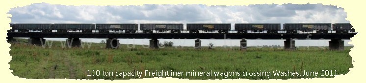
Like most watercourses in the Fens, this has more than one name because it is a hybrid being two rivers joined together, one of which has had several changes of name.
It starts at Earith Sluice where it is fed by the River Great Ouse (RGO) but only in flood conditions when the river level is high enough to open the sluices gates, and runs 18 miles to Welmore Lake Sluice where it discharges into the New Bedford/100 Foot River, another arm of the RGO, which is tidal, when tide levels are low enough for the vee doors to open.
Because of the restrictions above, the watercourse is managed by the Environment Agency (EA) under strict rules laid down in law, as explained in the Operation and Management section further down.
History
The southern section starts at Earith Sluice (bottom of map, marked 6 in black) and runs north-east. When cut in 1637 it was first called the Seventy Foot River but soon renamed Bedford River, and continued on to the Bedford Sluice at Salters Lode where it discharged into the River Great Ouse (RGO), known at this point as the "Tidal River" for obvious reasdons (TD).
At that time the Washes didn't exist. They were created in the mid 1650s, see my pages creation of the washes reservoir and definition of a wash. As a result, the Bedford River had "Old" prefixed to its name becoming the Old Bedford River (OBR). Soon afterwards, the OBR was dammed at what became known as Welches Dam (black 5) and its water allowed to overflow its lower east bank into the newly formed wash fields. Plan: Environment Agency
About a century later, in the 1750s, a new channel, named the Delph River (DR), was cut from Welches Dam running closely parallel to OBR for nearly 10 miles before bending right eastwards and crossing the washes to join the New Bedford River (NBR) where there is now a sluice at Welmore Lake.
The southern end of the Delph was then joined to the dammed-off section of the OBR at Welches Dam creating the kink in the combined watercourse OBR/DR that we see today.
The northern section of the (Old) Bedford River was joined joined to the Counterdrain at Welches Dam, again causing a kink in that channel. See my CD/OBR page.
Locally of course, sections are known by their individual names and for clarity I, like many others, do the same. Difficulty arises though when writers of official documents use
the local name of one section when referring to another.
Scroll down to follow the story or choose a section to jump to from the drop-down menu.
This section is based largely on the EA's Ouse Washes Water Level Management Plan produced by the Halcrow Group in 2002.
During flood conditions, when water levels in the Bedford Ouse upstream of
Earith rise beyond a predetermined level, Earith sluice opens automatically and
discharges water into the Old Bedford/Delph River. The level at which Earith
sluice starts to open is 3.17 m OD between November and March, and 3.77m OD
between April and October. These levels are statutorily governed by regulations
laid down in 1931 under the 1930 Land Drainage Act.
As levels in the Old Bedford/Delph River rise, water flows over its right bank
onto the Ouse Washes. The lowest Washes start to flood at about 0.7m OD and
by 1.7m OD most of the Ouse Washes are flooded. Levels above 2.40m OD flood
the Welney Road (the A1101) and above 2.75m OD flood the Sutton Gault
causeway, causing significant disruption to local traffic.
Floodwater flows northwards along the Ouse Washes and is discharged through
three pairs of tidal mitre gates in the John Martin (Welmore Lake) sluice when
levels in the Old Bedford/Delph River exceed those in the Hundred Foot River.
As levels in the Old Bedford/Delph River drop, water drains off the Ouse
Washes, initially on a broad front, and then through the internal ditch system.
In spring if levels in the Tidal River prevent gravity discharge to the desired summer
level of 0.5m OD, then two permanent 0.75 cumec capacity pumps at the John
Martin (Welmore Lake) sluice can be used to attain this level. Should the need
arise, provision has been made at the sluice for the installation of up to six
additional submersible pumps to assist the evacuation of stored floodwater from
the Ouse Washes.
The ideal winter water levels in the Old Bedford/ Delph River are a minimum of
1.0m OD from November to April to provide shallow flooding for overwintering
birds. This, however is not always possible, due to the primary function of the Ouse
Washes being a flood storage reservoir it is necessary to maximise the evacuation of
the flood water by pumps installed within the sluice and additionally by a separate pump house and 3 flap gates beyond the sluice to maintain the overall flood storage capacity of the Washes and
hence keeping the risk of Sutton Gault and Welney Roads flooding at a minimum.
Old Bedford River and River Delph
Created Mar 2013, last edited: 03/04/26, 17:04
Introduction
Inevitability, some images or text may be out of order or temporarily missing.
It starts at Earith Sluice where it is fed by the River Great Ouse (RGO) but only in flood conditions when the river level is high enough to open the sluices gates, and runs 18 miles to Welmore Lake Sluice where it discharges into the New Bedford/100 Foot River, another arm of the RGO, which is tidal, when tide levels are low enough for the vee doors to open.
Because of the restrictions above, the watercourse is managed by the Environment Agency (EA) under strict rules laid down in law, as explained in the Operation and Management section further down.
History
The southern section starts at Earith Sluice (bottom of map, marked 6 in black) and runs north-east. When cut in 1637 it was first called the Seventy Foot River but soon renamed Bedford River, and continued on to the Bedford Sluice at Salters Lode where it discharged into the River Great Ouse (RGO), known at this point as the "Tidal River" for obvious reasdons (TD).
At that time the Washes didn't exist. They were created in the mid 1650s, see my pages creation of the washes reservoir and definition of a wash. As a result, the Bedford River had "Old" prefixed to its name becoming the Old Bedford River (OBR). Soon afterwards, the OBR was dammed at what became known as Welches Dam (black 5) and its water allowed to overflow its lower east bank into the newly formed wash fields.
About a century later, in the 1750s, a new channel, named the Delph River (DR), was cut from Welches Dam running closely parallel to OBR for nearly 10 miles before bending right eastwards and crossing the washes to join the New Bedford River (NBR) where there is now a sluice at Welmore Lake.
The southern end of the Delph was then joined to the dammed-off section of the OBR at Welches Dam creating the kink in the combined watercourse OBR/DR that we see today.
The northern section of the (Old) Bedford River was joined joined to the Counterdrain at Welches Dam, again causing a kink in that channel. See my CD/OBR page.
Locally of course, sections are known by their individual names and for clarity I, like many others, do the same. Difficulty arises though when writers of official documents use the local name of one section when referring to another.
Scroll down to follow the story or choose a section to jump to from the drop-down menu.
Operation and Management
This section is based largely on the EA's Ouse Washes Water Level Management Plan produced by the Halcrow Group in 2002.
During flood conditions, when water levels in the Bedford Ouse upstream of Earith rise beyond a predetermined level, Earith sluice opens automatically and discharges water into the Old Bedford/Delph River. The level at which Earith sluice starts to open is 3.17 m OD between November and March, and 3.77m OD between April and October. These levels are statutorily governed by regulations laid down in 1931 under the 1930 Land Drainage Act.
As levels in the Old Bedford/Delph River rise, water flows over its right bank onto the Ouse Washes. The lowest Washes start to flood at about 0.7m OD and by 1.7m OD most of the Ouse Washes are flooded. Levels above 2.40m OD flood the Welney Road (the A1101) and above 2.75m OD flood the Sutton Gault causeway, causing significant disruption to local traffic.
Floodwater flows northwards along the Ouse Washes and is discharged through three pairs of tidal mitre gates in the John Martin (Welmore Lake) sluice when levels in the Old Bedford/Delph River exceed those in the Hundred Foot River. As levels in the Old Bedford/Delph River drop, water drains off the Ouse Washes, initially on a broad front, and then through the internal ditch system.
In spring if levels in the Tidal River prevent gravity discharge to the desired summer level of 0.5m OD, then two permanent 0.75 cumec capacity pumps at the John Martin (Welmore Lake) sluice can be used to attain this level. Should the need arise, provision has been made at the sluice for the installation of up to six additional submersible pumps to assist the evacuation of stored floodwater from the Ouse Washes.
The ideal winter water levels in the Old Bedford/ Delph River are a minimum of 1.0m OD from November to April to provide shallow flooding for overwintering birds. This, however is not always possible, due to the primary function of the Ouse Washes being a flood storage reservoir it is necessary to maximise the evacuation of the flood water by pumps installed within the sluice and additionally by a separate pump house and 3 flap gates beyond the sluice to maintain the overall flood storage capacity of the Washes and hence keeping the risk of Sutton Gault and Welney Roads flooding at a minimum.
Details and photos of Earith Sluice are at my Earith Sluice page.
Details and photos of the sluice and pumps at Welmore Lake are at my Welmore Lake Sluice page.
Sluices, weirs and locks
Pumping Stations
If you think there are any errors or ommissions on this page or would like to comment, please e-mail me and your response will be added.