The
|
|
Welcome to my independent research project on
at
- Contents of this page
- related pages on this site
- related pages on other sites
- Home page and full site index
- Recommended OS Maps
- page created: 01 Sep 2011
- last updated: 25 Nov 2025
- Please "refresh"/"reload" page
Your computer stores images of webpages you visit in a "cache". When you re-visit, the stored page may be displayed. To see if it has changed, click the "refresh" or "reload" icon at top of screen. Designs/colours vary, examples:


- Copywright, acknowledgements
- Can you correct/add anything?
| The Ouse Washes Website Middle Level Transfer Scheme |
Middle Level Transfer Scheme
Introduction
This was a scheme to abstract a measured amount of water from the Great Ouse (Bedford Ouse) at Earith into the Old Bedford River via three 300mm (12 inch) pipes under the centre sluice gate then draw the same quantity from the Old Bedford further downstream at Welches Dam and pump it under the Counterdrain into the Forty Foot Drain for summer irrigation purposes within the Middle Level area.
The earliest reference I found to this scheme was a notice in the London Gazette in May 1985 in which the Anglian Water Authority had applied for an abstraction licence under the Water Resources Acts of 1963 and 1971. Abstraction was licenced during the period April-September and when the level in the Bedford Ouse was above 2.13m (7ft) AOD. Maximum quantities permitted were 554,400 galls (2,520m2) per hour and 8.8m galls (40k m2) per day, but subject to a 30-day and annual cap.
In 2010-11 the EA issued conflicting information about the schem's status. For example:
The EA drought plan for Anglian Region Central Area in April 2010 stated:
"transfer is technically feasible, as the equipment including the diversion valve has recently been refurbished. However the licence that authorises the transfer has expired and is due for a review".Yet the EA's Mr Ryan Ely wrote in a report to Earith Parish Council in 2011:
"the centre gate [at Earith] reinstalled and the damboards removed .... the redundant water transfer system below the centre gate has been removed".
Abstraction from Bedford Ouse at Earith
When viewed in 2011 and 2012 the inlet pipes were still in place but appeared to be blanked off.
 Photo: EE, May 2011
Centre gate removed & temporary damboards fitted, transfer pipes clearly visible below. |
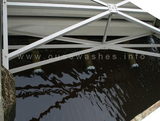 Photo: EE, April 2012
Centre gate re-installed after repairs, pipes still in position apparently contradicting Mr Ryan Ely's statement above. |
| If you are unfamiliar with or confused about the watercourses surrounding or adjacent to the Ouse Washes, my features page explains the overall situation on the rivers section, or go to my CD/OBR page for a more detailed account of this particular river. |
Abstraction into Middle Level via Forty Foot River near Welches Dam
This was achieved by a small pumping station at grid ref TL 471859 which re-abstracted the same quantities of water out of the Old Bedford River via a pipe laid over the barrier bank situated south (upstream) of Welches Dam Pumping Station. The pipe then went under the Counterdrain, over the low (outer) bank of the Counterdrain into the Forty Foot River by the side of the Forty Foot/Welches Dam lock. A fairly recent new section of pipe was evident when I visited the site in 2011 and 2012.The control room for the pump was a timber hut subject to Local Authority planning consent. In April 2000 permission was granted to continued stationing of the temporary hut until 29th May 2005 at which time it would have to be removed. It wasn't, so I assume futher permission was granted. It was however gone in 2015 as noted by a member of the IWA Peterborough.
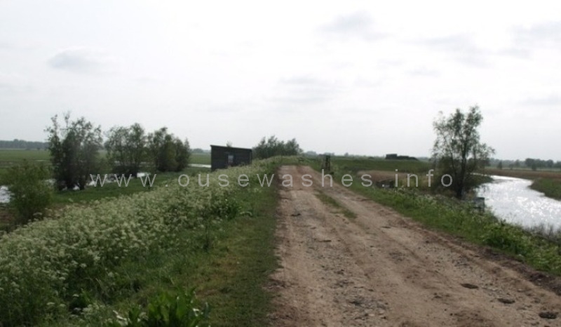 Photo: EE, April 2011
Looking south. Extreme left is the Old Bedford River (which becomes the Delph River); in centre is the barrier bank and the wooden pumphouse; on the right is the Counter Drain (which becomes the Old Bedford River). |
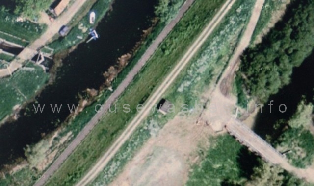 Satelite view by Google
Coming in on the left is the Forty Foot river and lock into the Counterdrain. Centre is the wooden transfer pumphouse on the Middle Level barrier bank. Right is the Old Bedford River and a Bailey bridge leading into the Washes. |
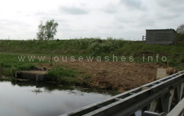 Photo: EE, April 2011 Seen from the Bailey Bridge, inlet is at centre left, pump-house is top right, joined by pipe laid on surface of barrier bank. |
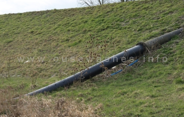 Photo: EE, Feb 2012 new shiny-black section of inlet water pipe with small blue pipe below |
 Photo: EE, Feb 2012 entrance end of pumphouse |
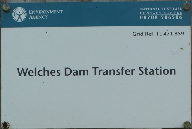 Photo: EE, sign on door |
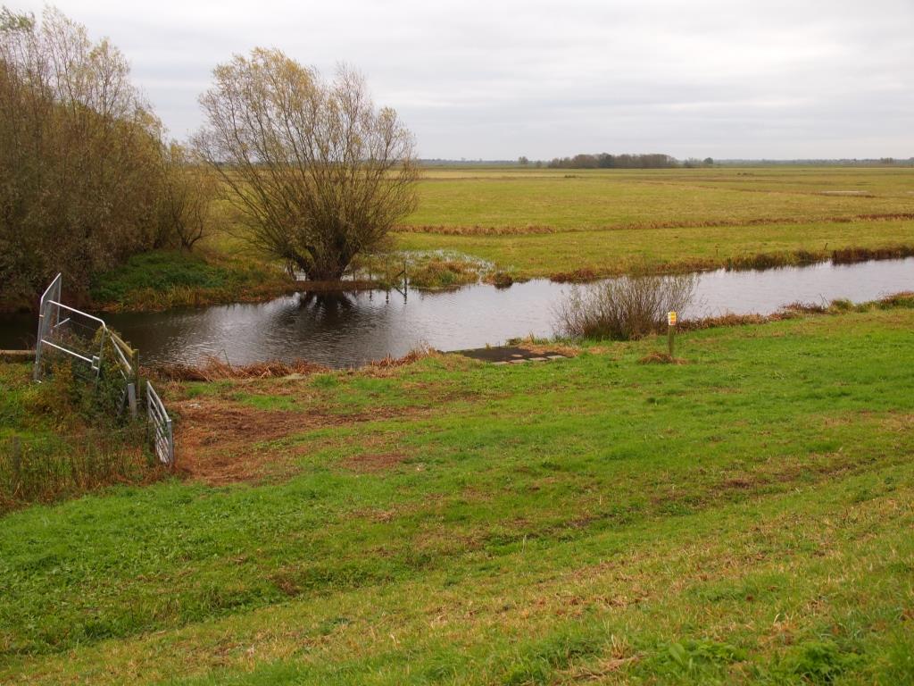 Photo: Peter Cox, Nov 2017 General are of site of inlet from Delph, seen in Nov 2017 |
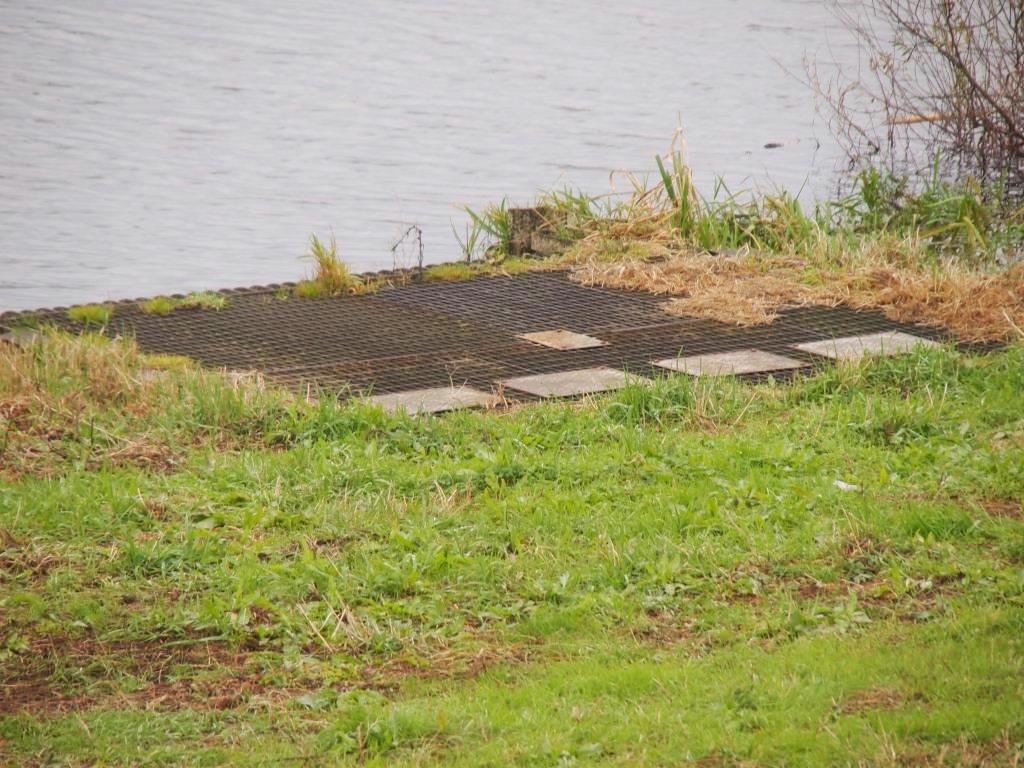 Photo: Peter Cox, Nov 2017 close up site of inlet from Delph covered over, seen in Nov 2017 |
Discharge into Forty Foot River
The pipes and controls on the far side of the Forty Foot lock all looked quite new when I visited in 2012.
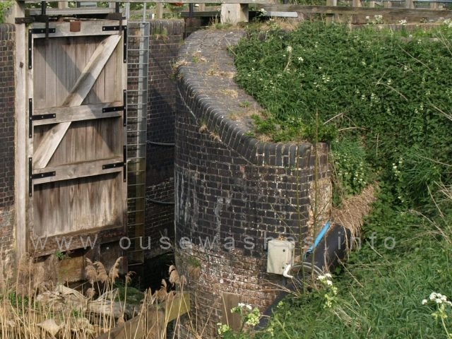 Photo: EE, Apr 2011 Small blue pipe and large black pipe below coming out of the low bank. Grey/white control box (?) on lock wall. |
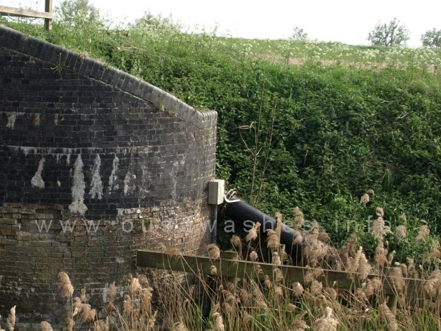 Photo: EE, Apr 2011 As seen from other side of the Forty foot |
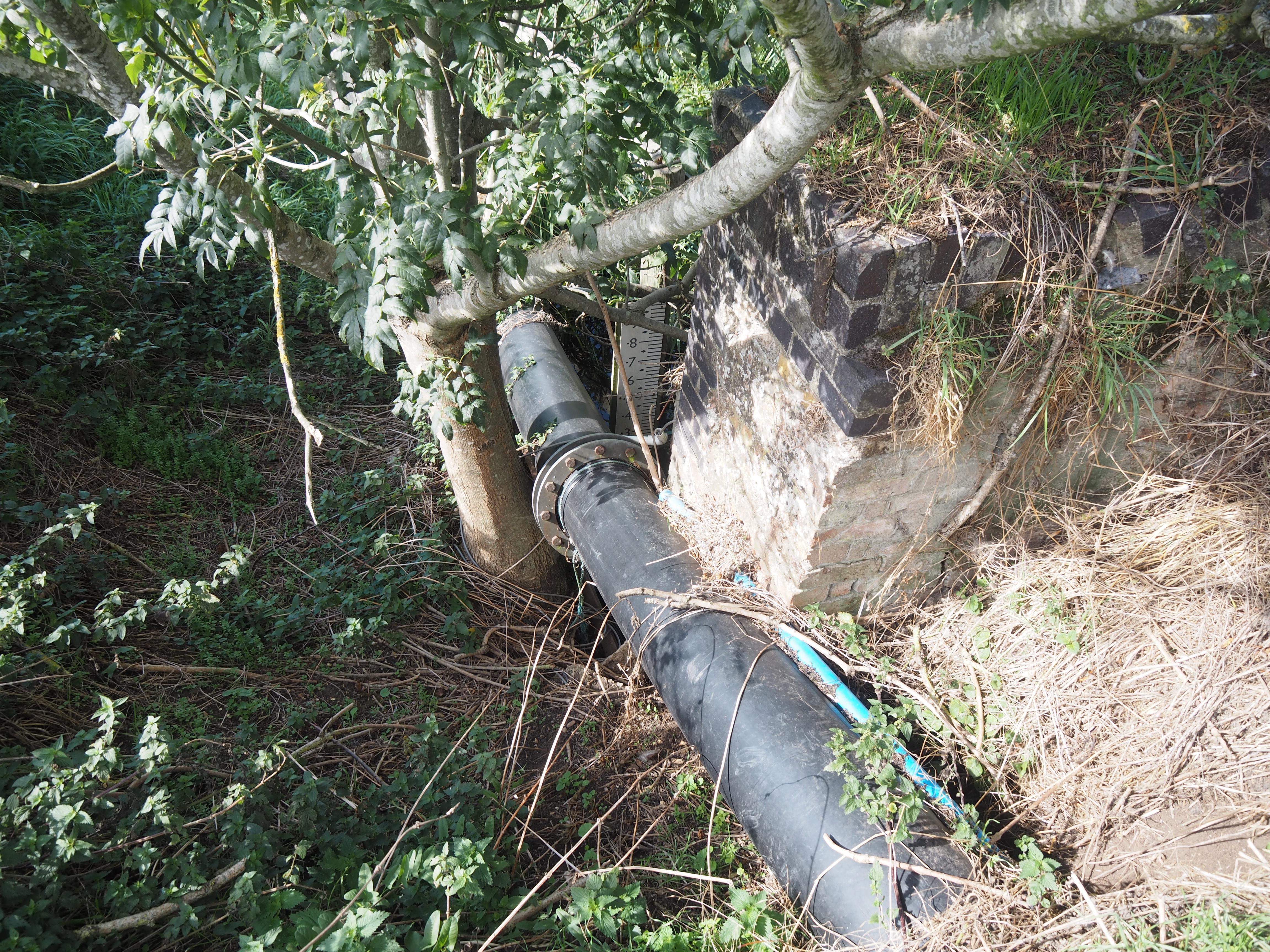 Photo: Peter Cox, Sept 2025 Pipe still in place in Sept 2025 |
Notes, sources and bibliograhy
| ref | notes, sources and glossary used in text and tables throughout this page |
| 1 | |
| 2 | |
| 3 | |
| 4 | |
| 5 | |
| 6 | |
| 7 | |
| 8 | |
| 9 | m3/s = cubic metres per second, commonly called cumecs |